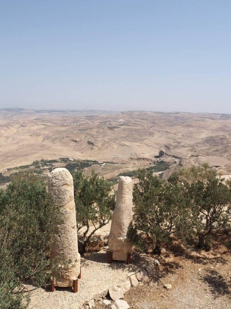
“At half an hour from Howash [al-Hawwash, north of Apamea] we met with several fragments of shafts of columns, on the side of an ancient paved causeway. We followed this causeway for upwards of an hour, although in some places no remains of it were visible; at the distance of a quarter of an hour (at the rate of about three miles and a half an hour), from the first heap of fragments of columns, we met with a similar heap; then at an equal interval a third, and again a fourth; not more than four columns seemed to have stood together in any of these places. We conjectured that this had been a Roman road, and the columns its milliaria.” J. L. Burkhardt, Travels in Syria and the Holy Land (1822), 136.
This passage from Johann Ludwig Burkhardt’s account of his travels through Syria in the 1810s invites us to consider one possibility for understanding ancient milestones not only as indicators of distance, but as indicators of time. Burkhard may well have possessed a pocket watch – he was, after all, Swiss (albeit travelling in disguise as a Muslim sheikh). Mechanical pocket watches became increasingly popular from the mid-18th century, and such a precision instrument would account for Burckhardt’s tracking the passage of time in terms of quarter-hours. This degree of precision contrasts with most of our surviving written accounts of late antique travel: when speaking of travel distance in terms of duration of time, travellers and pilgrims typically speak of days of travel. It seems that generally people had little need to record increments of time shorter than an hour. However, it was nonetheless possible to keep track of the passage of time by relying on the position of the sun, both with the use of a timepiece or without. By tracking the passing of the milestones in conjunction with the movement of the sun in the sky, a traveller could at least be able to estimate if they were maintaining a steady walking pace, and whether they were likely to make their destination before nightfall.
The rate of travel of an individual on foot, walking on a level, paved surface, is about 5 km per hour. This converts to 3.37 Roman miles – Burckhardt’s rate of 3.5 miles per hour would equate to 3.8 Roman miles. The main highways of the Roman empire were marked by milestones set one Roman mile – milia passuum – apart. A classic Roman imperial milestone would bear an inscription typically starting with the name and titles of the emperor, then the provincial official under whom the roadwork was carried out, and sometimes the military legion doing the work. On a more practical level, the milestone could also bear the name of the principal destination of the road, the caput viae, and – most essentially – the mile distance to that destination. However, most milestones were uninscribed, and occasionally appeared in clusters as described by Burckhardt above. Even without the inscriptions, milestones or clusters of mile markers served as visible and distinctive landmarks along the road. If a traveller were maintaining a steady pace, they would expect to pass at least three mile stations in an hour; making it to a fourth to stay on schedule might incentivize a burst of speed.
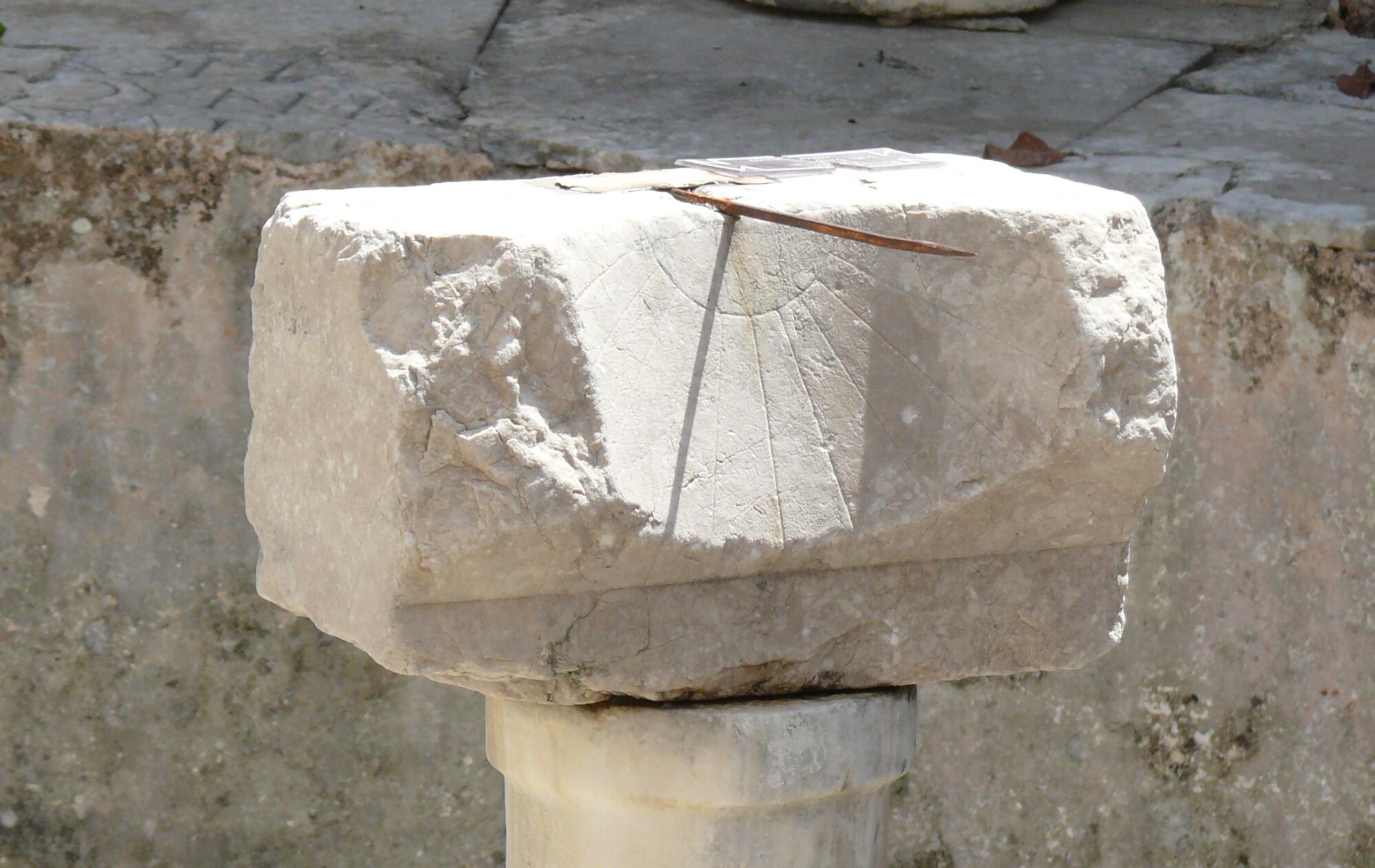
Devices for monitoring the passage of time, such as water clocks and sundials, did – of course – exist in antiquity. The majority of sundials were monumental and positioned where they were publicly visible: they were stationary both by virtue of their size and the astronomical mathematics that make them work. A sundial was designed to break up the period between sunrise and sunset into equal twelfths, the increments being longer in the summer and shorter in the winter. The time indicated by the shadow of a sundial’s gnomon thus depends on the angle of the sun’s altitude above the horizon and the horizontal angle of the sun’s position left or right of a fixed cardinal direction – usually due south. The sun’s position along these axes not only varies by season, it also changes by latitude, making a sundial only practical for use in the place for which it was calibrated. Their physical and geographic fixedness are somewhat antithetical to the open road.
However, Vitruvius, in the section of De Architectura on time and time-keeping, speaks of what was to him a well-known category of time-keeping devices known as the viatoria pensilia, or travellers’ pendants (or hanging dials) (Vitruvius, De Architectura 9.8.1.). About twenty-five objects matching Vitruvius’s description are known from Greco-Roman antiquity, several of which date from the fourth century or later. Of these, sixteen can be set to different latitudes (using interchangeable plates or other moveable elements) and so might be of actual practical use to travellers covering long distances. Typically made of brass or bronze, a few are cylindrical in shape, but the majority are in the form of flat disks or medallions, with a diameter of between 5 and 12 centimetres.
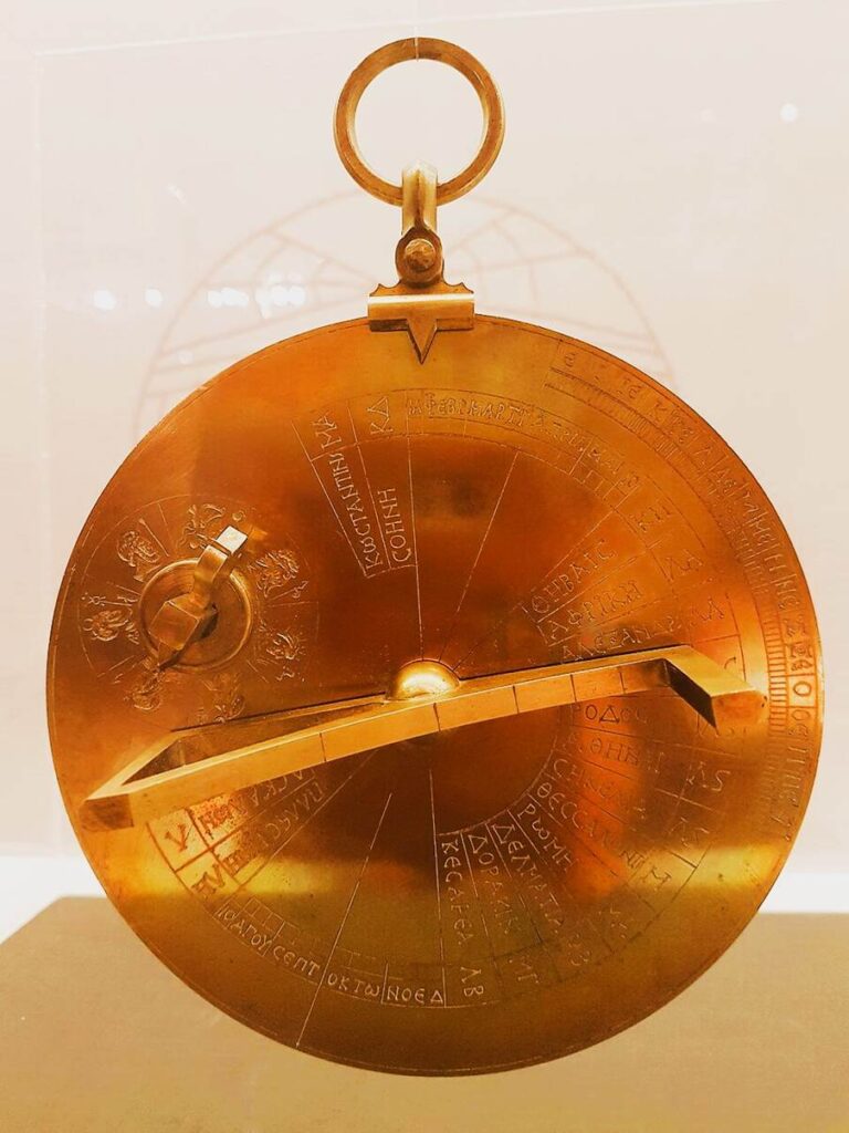
Despite the casualness with which Vitruvius drops them into his discussion of timekeeping, portable sundials were probably not commonplace items found in every traveller’s kit. For one thing, they were not terribly accurate. The multiple-latitude versions required the user to know – in addition to the date and its effect on the sun’s position – either the exact latitude to determine the time or the exact time to be able to determine the latitude. The fancier types of engraved dials include place names and numerals to suggest that precise latitudes are being provided (likely on the basis of the coordinates found in Ptolemy’s Geography). But these data are not always accurate, and on some examples, rather than giving the names of cities, entire regions or provinces are named, ignoring that these territories span many degrees of latitude making any readings an approximation at best. They were probably more intellectual curiosities than objects of practical navigation. Richard Talbert’s interpretation of the function of these objects is to regard them as symbolic objects reflective of a cultural and political worldview: an expression of Late Roman imperium. The arrangement of geographical information on the dials of these portable sundials thus evokes a Roman worldview in which ease of travel and accessibility between places speaks of the power and extent of Roman rule – like carrying the empire in your pocket.
However, such gee-gaws and fancy toys were not necessary for a reckoning of time, especially in a lived context where familiarity with the daily, monthly and annual cycle of the sun and moon were far more ingrained than they are today. An approximate reading of the hour can be done without recourse to a mechanical device by tracking the angular movements of the sun across the firmament (although similar limitations regarding latitude, season, and cardinal direction apply – and, of course, the sun needs to be shining). The sun’s position in the sky changes at a rate of 15 degrees per hour, which is approximately the distance between the index and little fingers when making the “rock on” gesture (index and pinky extended, other fingers folded in) with an outstretched arm. The width of an adult finger corresponds to about 5 degrees – just over 15 minutes.
Tracking the movement of the sun in this way requires some sort of fixed point. Using a fixed point on the horizon or objects in the distance is difficult when travelling as despite the common perception, not all Roman roads were dead straight. This method works best when measured from the zenith, the sun’s highest point during the day. If the traveller knows which way is south, they can estimate the zenith and use hand and finger-widths to estimate the passage of time relative to the noon point. Experience would likely mean that the finger trick was unnecessary, as being attuned to the daily and annual motions of the sun would have been part of common practice. A person using only the sun for time-keeping, provided they were aware of their orientation, is more or less able to keep time to roughly 15-minute increments.
Knowing that one should expect to encounter a set of milestones every quarter of an hour, or – what is more likely given what we know of time reckoning in antiquity – four sets within the time it takes the sun to move the width of one’s fingers, would help a traveller maintain a steady rate, as well as keeping them on course.
Marlena Whiting (University of Groningen)
References
Burckhardt, Johann Ludwig. Travels in Syria and the Holy Land. London: John Murray, 1822.
Talbert, Richard J. A. Roman Portable Sundials: The Empire in Your Hand. Oxford: Oxford University Press, 2017. https://doi.org/10.1093/acprof:oso/9780190273484.001.0001.
Savoie, Denis. “Three Examples of Ancient ‘Universal’ Portable Sundials.” In Instruments – Observations – Theories: Studies in the History of Astronomy in Honor of James Evans, edited by Alexander Jones and Christián Carman, 45–77. Zenodo, 2020. https://doi.org/10.5281/zenodo.3975719.